The Place
The Sailboat
 The
San Juan Islands in Washington State are one of the most beautiful but
challenging places to sail. The information below will give the
sailing characteristics of the setting and sailboat. To the left are
two links which contain a detailed description of our tracks, tides, currents
and photographs of the trip.
Winds: Often light in July
and Aug. On my sails in the region the best wind is in morning
from 6:00 am to 11:00 am. I have had ample wind on all of my
trips which were in early June.
"The first rule for Coastal Cruising: start early; finish early." -
Anonymous.
Tides: The tides range from about 2 feet in a neap tide up
to 11 feet in a spring tide. The tides can create currents up to
6 knots. In certain areas, the water can be funneled through the islands creating strong currents and eddies.
Waves: Because of the small fetch, waves are usually small
unless a strong wind is blowing against a strong current in a strait.
Currents: May be up to 6 knots in a spring tide. (This is
the large tide which occurs during a full and new moon, not a tide in
the springtime).
Bottom: Many rocks and groundings are usually hard.
Anchorages must be done in selected areas that are charted in order to
find a favorable bottom.
Water Temperature: 48 to 50 deg. Hypothermia is a real
danger in any man-overboard situation.
Because of the tidal currents, the
course to steer is often not the same as the course to make good.
One should use a range (lining up two
landmarks on shore) or satellite
navigation system to maintain a proper heading.
Judging the speed of the wind by the
appearance of the water must be done with consideration of the current.
A wind blowing against a 6 knot current will form high waves and white
caps around 10 - 12 knots. However, when blowing with the current
the formation of white caps and significant waves may be delayed to around
18 to 20 knots.
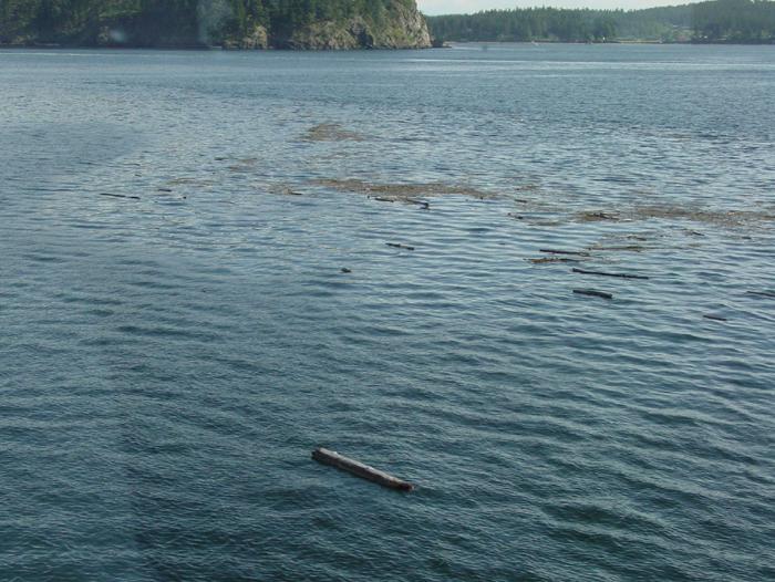
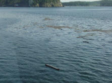 Another
challenge is the formation of dead wind zones at channel junctions and eddies which trap and accumulate logs and
kelp. Crossing these areas must be done carefully. Logs can
damage or puncture the hull and kelp can foul the prop. Remember you
may be in a situation of high current and low winds which will require
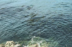
motoring to safely navigate the waters. To the right is a photograph
of debris trapped in a dead wind zone at the junction of two water
channels. Note the difference in the water surface indicating
different wind conditions.
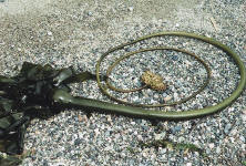
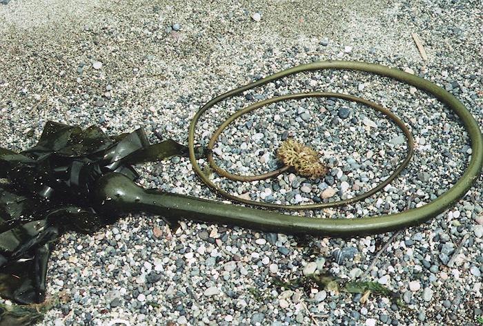
 To the right are pictures of
Nereocystis luetkeana,
a common kelp encountered in the Pacific Northwest. This kelp
commonly obtains lengths of over 10 feet and can easily foul a prop.
For more information see:
http://life.bio.sunysb.edu/marinebio/kelpforest.html
 One
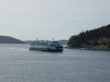
should also remember that a sailboat must give way to large vessels
restrained by their size, fishing boats engaged in fishing and ferries.
 Sailboat:
The Sailboat was a Catalina 34.5. this
boat has a fin keel with a weight of 11.950 lb, a draft of 5' 7" and
a D/L of 201(a light cruiser ).
Go To Top
The navigational system used was a hand-held
satellite map GPS system, which continuously displayed the position and
heading (track) of the sailboat on a nautical map. We also had a
backup hand compass.
PFD: Our PFDs were CO2
inflatables. The CO2 cartridges could not be shipped by
mail or airlines. After we arrived we bought new cartridges in
Anacortes.
CO2 Cartridges are consider
hazardous material. They may not be taken on-board airplanes without
prior approval of the air carrier--See
Regulation Title 49 part 175. They can be shipped
separately by an air shipping service but they must be declared and a
hazardous material permit is often required.