|
|
|
|
    This section is for educational purposes only. It is not to be used to plan an actual trip or as an aid to navigate waters.
Kevin Kavanagh
and his associates assume no liability for the information presented on
this website. The user is responsible to check the validity of all
information. For comments:
|
 This crossing
required a high degree of vigilance. One must cross Boundary Pass in order to
reach Canada. This pass has heavy traffic and large tidal currents.
The currents also will hit the boat on its beam and tend to push the boat
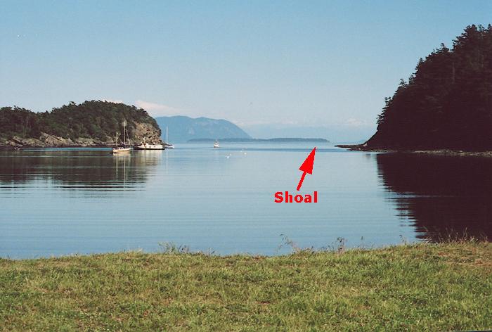
into a dangerous shoal, between Waldron Island and Skipjack Island.
This passage was sailed during a neap tide where the water level
difference between low and high tide was only two feet.
A total distance of 15.2 nautical miles by waypoints, with a total 16.2
nautical miles logged to reach the destination. |
|
|
1. Fossil Bay
- 0.5 Nautical Miles 7:45
am: We left Fossil Bay staying on the northeast side of the harbor entrance
to avoid the shoal on the southwest side.
Ten minutes later we were under sail heading 240 Deg. True. The boat speed was 6.7 knots with a 13 knot wind. A 0.25 to 0.5 knot current was hitting the boat at 60 degrees. This would require a 2 to 4 degree course correction. However, our point of sail was a close reach and the leeway (the pushing of the boat leeward by the wind) the sailboat experienced counteracted any influence of the current. Thus no course correction was needed. The current at 8:00 am is shown in the above diagram. Note that the strongest current is between Waldron Island and Skipjack Island, right where the shoal is located. This is the current on a neap tide. * Current Atlas--Juan de Fuca Strait to Strait of George. Canadian Hydrographic Service, Pacific Region. Puget Sound Vessel Traffic Area |
|
|
|
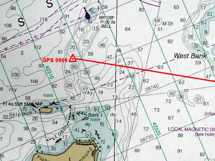
3. President Channel to Boundary Pass - 4.78 Nautical Miles We made this crossing at the time of slack water during a neap tide (see above tide table.) There are two hazards in this area: 1) A shoal between Skipjack Island and Waldron Island. 2) The west bank. The Mean Lower Low Water Level (chart depth) at the west bank is 7.9 feet. At the time of our crossing there was approximately 3.0 feet of tide height above the Mean LLW (chart depth). Our boat's draft was 5.7 feet.
Chart Depth = 7.9 feet At 9:00 am by the time we reached the region of Skipjack Island, the current was now about .75 knots. The water speed of the sailboat was 2.6 knots with a 4 knot wind. The current was at a 90 degree angle to our boat. Our heading was 274 degrees T and we had a course to steer of 290 degrees T. We checked our position at 0900 by three methods: 1)
A reading on our GPS showed our position to be |
|
|
|
4.
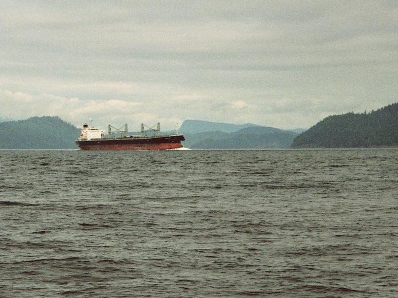
Boundary Pass - 11. 8 Nautical Miles Traveled, 7.3 Nautical Miles by Waypoints During this part of the passage we were tacking against a 5 knot wind and against a small current, traveling about 3.0 knots as measured by GPS. This is a very busy channel with commercial traffic. There are no travel restrictions for recreational craft except for the rules of the road and the 100 meter security zone around commercial vessels. Commercial vessels will appear to be traveling slower than they actually are and thus should be given a wide berth. A radar reflector should be hoisted so commercial ships can more easily detect your craft.
|
|
|
|
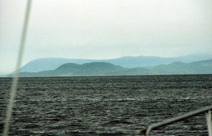
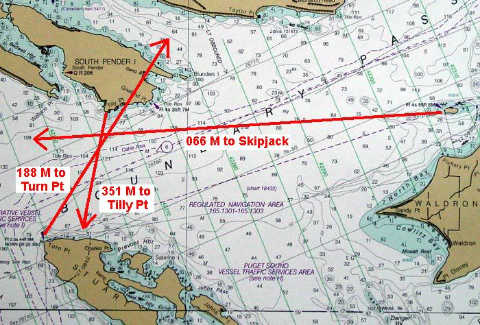
Taking a Fix. Before leaving Boundary Pass to approach Bedwell
Harbor, a Fix was plotted by determining three landmarks' bearings
from the boat.
1) Tilly Point South Pender Island -
Canada
|
|
|
|
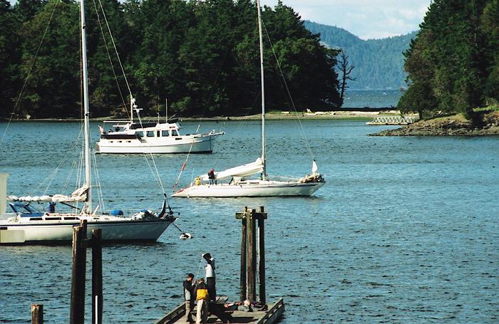
5. Entering Bedwell Harbor - Canada - 1.9 Nautical Miles At 12:00 noon, the wind died and we turned on the motor to navigate the last 2 miles of the Journey. We maintained a heading of 325 Degrees True to enter Bedwell Harbor. To the right shows the lighted daymark on South Pender Island at the entrance of Bedwell Harbor. We arrived at 12:00 noon.
|
|
|
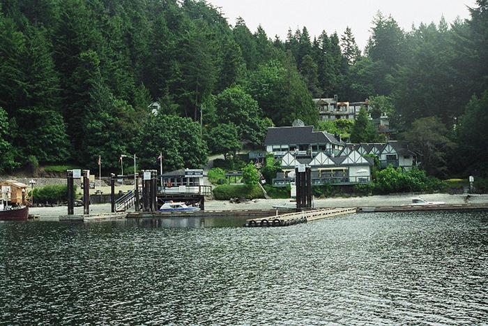 6. Bedwell
Harbor & Canadian Customs: Canadian Customs required a passport or birth certificate. No pitted or seed containing fruits were allowed ( peaches, apples, etc. also potatoes. ) In Canadian waters, the sailboat must have a FCC License for the VHF Radio.
|
||
|
* Current Atlas--Juan de Fuca Strait to Strait of George. Canadian Hydrographic Service, Pacific Region. Puget Sound Vessel Traffic Area |
||